The National Weather Service has confirmed there were three tornado touchdowns in Vermilion County during the storms which passed through the area on Tuesday (May 20, 2025). Bill Pickett has more…
All three touchdowns were brief according to information compiled by a team from the National Weather Service at Lincoln which toured areas of the county to survey possible storm damage.
An Armstrong – Potomac Tornado had estimated peak winds of 90 miles per hour. It tracked for just over five miles with a maximum width of 80 yards and was categorized as an EF1 tornado. The tornado touched down at 5:06 p.m. Tuesday about 3 miles south of Armstrong along North 270 East Road where it damaged some trees. It then moved east along North 650 East Road where it snapped two power poles. It was caught on video approaching Potomac-Collison Road before snapping or uprooting 12 large trees, roughly 2 feet in diameter. The twister dissipated shortly thereafter.
The Collison Tornado tracked for seven miles with estimated winds of 70 miles per hour and a maximum width of 40 yards. It first touched down shortly after 5:00 p.m. about 4 miles southwest of Collison where it damaged some trees. It was videotaped by storm spotters as it passed about 2 miles southeast of Collison where it damaged more trees. It then progressed northeast through the Horseshoe Bottom Nature Preserve where it damaged more trees before dissipating along East 200 North Road.
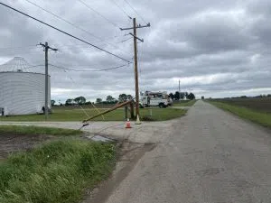
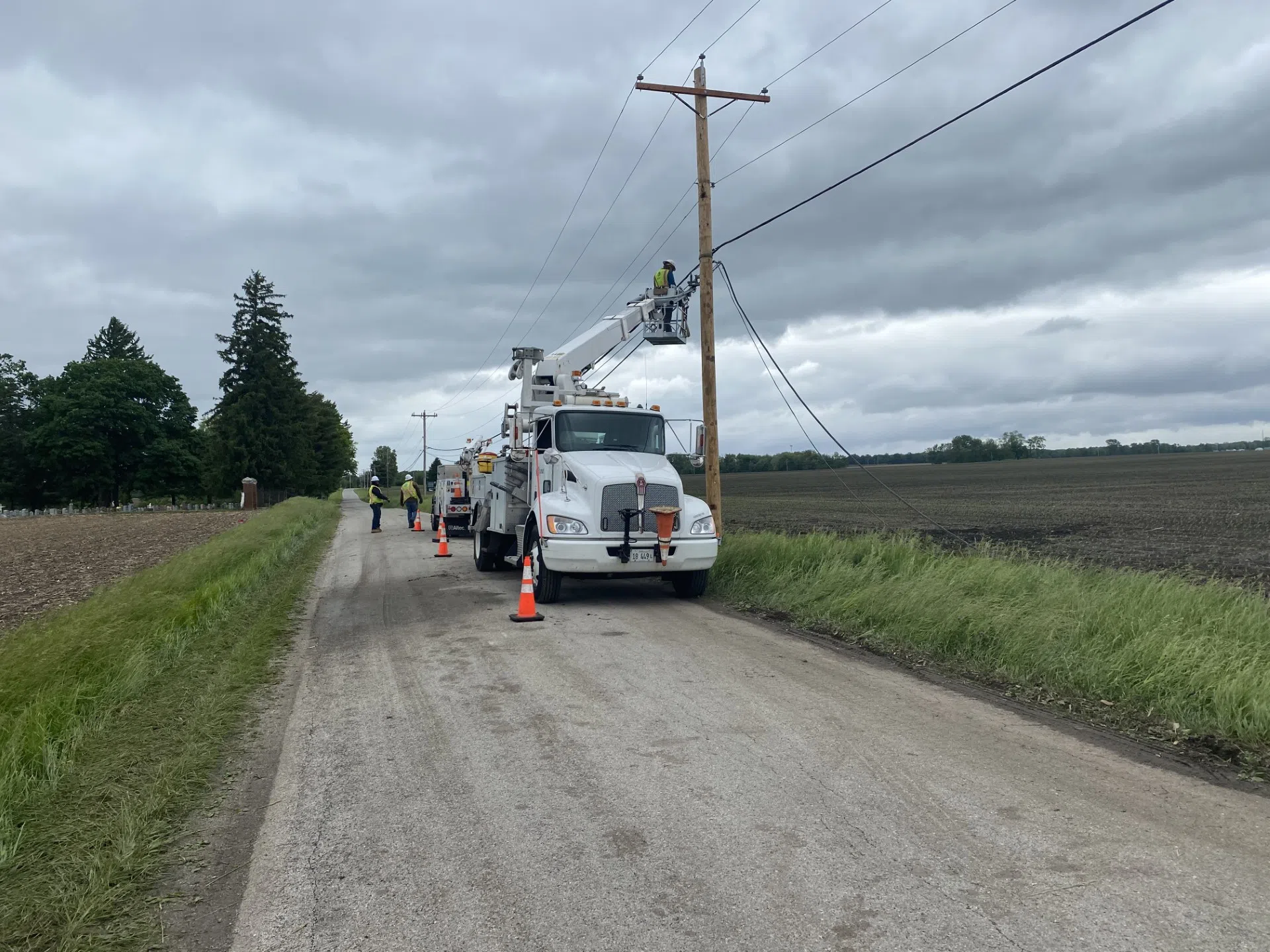
{Strong winds snapped some power poles east of Westville Tuesday. The photos show an AT&T crew repairing the damage Wednesday, May 21, 2025.}
The Weather Service says the third confirmed tornado touchdown in Vermilion County Tuesday evening was near Bismarck. It touched down at 5:39 p.m. about 3 miles east of Bismarck with estimated peak winds of 75 miles per hour. The storm hit as an 8th grade graduation ceremony was taking place at the Bismarck-Henning Junior High. Vermilion County Emergency Management says those in attendance took shelter in the lower level of the building until the storm passed. It tracked 1.8 miles after causing some tree damage along East 2500 North Road. As it moved northeast the tornado damaged the roof of an outbuilding before dissipating as it approached the Indiana state line.
There were no injuries or deaths associated with any of the Vermilion County storms. The Weather Service determined that damage in the Westville area was caused by straight line winds estimated between 60 and 100 miles per hour. Damage there was mostly to trees, however a handful of power poles had to be replaced east of Westville due to storm damage.
{Our thanks to the National Weather Service in Lincoln Illinois, which provided information for this story. More information can be found at their website at https://www.weather.gov.}